Living In San Carlos: Neighborhoods, Parks, And Daily Life
April 2, 2026
April 2, 2026
If you are considering a move on the Peninsula, San Carlos often stands out for a simple reason: daily life can feel surprisingly easy here. You have a compact downtown, a strong parks system, and practical transit connections all woven into one small city. If you want to understand what it is really like to live in San Carlos, this guide will walk you through the neighborhoods, outdoor spaces, and day-to-day rhythm that shape the experience. Let’s dive in.
San Carlos is set up for a neighborhood-centered lifestyle. According to the city’s General Plan, downtown Laurel Street is designed as a pleasant pedestrian environment with landscaping and pedestrian amenities, while city economic materials describe downtown as a thriving, walkable area with local-serving retail, grocery options, and restaurants.
That matters in everyday life. Instead of relying on long drives for every errand, you can often stay close to home for dining, services, parks, and community events. The city also connects well to larger Peninsula job centers through Highway 101, Caltrain, and the San Carlos Transit Center, which helps balance local convenience with regional access.
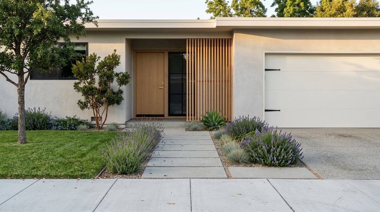
Downtown is the heart of San Carlos for many residents. The city defines the downtown area as Laurel Street from Holly Street to Arroyo Street, along with nearby properties west to Walnut Street and the civic center, with the historic core centered on parts of San Carlos Avenue and Laurel Street in the 600 through 1200 blocks, according to the General Plan.
The design of downtown supports walking as part of your normal routine. Buildings along Laurel Street are generally built close to the sidewalk, and the area south of Arroyo Street includes a mix of restaurants, retail, offices, and some mixed-use or residential buildings. That layout gives downtown a steady, active feel without making it feel oversized.
The civic core is also tightly grouped. The city’s contact page places the Adult Community Center at 601 Chestnut Street and the library at 610 Elm Street, with Parks & Recreation nearby as well. In practice, that concentration makes it easier to combine errands, appointments, and leisure in one short trip.
San Carlos is not just about physical layout. It also has a strong recurring community rhythm that gives the city an active feel throughout the year. Official city newsletters highlight a year-round Sunday farmers market on Laurel Street, along with recurring events like Music in the Park, summer movie nights, Hometown Days, and Night of Holiday Lights.
These events help downtown and the parks feel like shared gathering places rather than just amenities on a map. If you value a city where public spaces are actually used and activated, San Carlos offers that. It creates a routine where weekends and evenings can feel just as connected as the workweek.
San Carlos is not typically discussed through a long list of formal neighborhood names in city planning documents. Instead, the clearest way to understand the city is through its broader residential patterns. City materials show that San Carlos is largely single-family residential, while multifamily buildings are more common along El Camino Real, Laurel Street, and San Carlos Avenue, according to the city’s Sewer Collection System Master Plan.
The city’s growth pattern also helps explain how different parts of San Carlos feel today. The oldest areas developed in the 1920s, major growth followed in the 1940s and 1950s, and later expansion moved into the western hills. That history created a city with distinct lifestyle pockets, even if they are not always labeled as formal neighborhoods.
In the flatter areas closer to downtown and the rail corridor, streets often feel more connected to the city’s historic pattern of development. Based on city land use and development history, this part of San Carlos generally reflects older residential streets with easier access to downtown services, parks, and transit.
For many buyers, this area appeals because of convenience. You may find it easier to reach Laurel Street, the library, civic services, and Caltrain without crossing as much topography. If your ideal lifestyle includes local errands, dining out, and a more connected street grid, the flatter parts of San Carlos often support that well.
As San Carlos rises westward, the character changes. The city’s development history supports a more topographic, view-oriented residential pattern in the western hills, with homes shaped by elevation and hillside streets rather than the flatter downtown grid.
This part of the city often feels more residential and more removed from the downtown core, even though it remains part of the same compact community. For some buyers, that tradeoff is appealing because it offers a different relationship to open space, views, and the natural landscape.
The eastern side of San Carlos serves a somewhat different role. City planning materials describe this area near the Caltrain corridor and Highway 101 as an edge with industrial, retail, and life-science activity, according to city planning documents.
That does not make it a traditional residential destination in the same way as the flats or hills. Instead, it is part of what makes San Carlos practical, adding services, employment uses, and transportation connections that support the broader community.
Parks are a major part of daily life in San Carlos. The city’s park system ranges from neighborhood green spaces to hillside open space, which means your experience outdoors can vary from a quick local walk to a longer trail outing.
The city’s General Plan park inventory identifies Burton Park as the city’s oldest and best-known developed park. It includes fields, tennis and basketball courts, play areas, a recreation building, and picnic amenities. Arguello Park is the largest developed park, while Big Canyon Park offers a more rustic hillside setting with a trail and broad views, and Eaton Park provides larger open-space conditions with trails and wildlife.
Burton Park plays an outsized role in city life. It is not only a developed park with a broad range of recreation amenities, but also a major event setting. City newsletters place Hometown Days, Music in the Park, and movie nights there, making it one of the clearest examples of how recreation and community life overlap in San Carlos.
If you are looking for a place that acts as both a park and a social anchor, Burton Park is central to that experience. It gives San Carlos an active public gathering space beyond downtown.
San Carlos also has smaller parks that support everyday use. The General Plan notes that Highlands Park supports year-round athletics, Laurel Street Park serves as a downtown pause point, and parks such as Vista Park, Laureola Park, and City Hall Park support walking, play, and passive use.
That variety matters because it gives the city layers of outdoor access. You are not limited to one major destination. Instead, parks are spread through the community in a way that supports both routine use and larger weekend plans.
One subtle but important part of living in San Carlos is its greenery. City newsletters note that San Carlos has mature native trees that contribute shade, cooling, and visual character, while city materials also emphasize tree preservation and the urban canopy in shaping the local environment.
This helps explain why many residential streets feel established and comfortable. The tree canopy softens the built environment and adds to the sense that San Carlos is a city where public space and neighborhood identity have been cared for over time.
San Carlos offers a strong mix of local convenience and regional access. The city has a Caltrain station in Zone 2 on the Peninsula corridor, and Caltrain notes that the system serves stations between San Francisco and San Jose on weekdays, with parking and bicycle access at most stations.
City economic materials also point to Highway 101, the downtown station, and the San Carlos Transit Center as key mobility assets. The same materials describe San Carlos as roughly equidistant between San Francisco and San Jose, with bus connections into the rest of San Mateo County.
For many residents, that combination supports flexibility. You can keep many daily errands local while still maintaining access to larger regional job centers. That balance is one reason San Carlos continues to appeal to buyers who want a Peninsula location that feels both connected and manageable.
San Carlos can work well for a range of buyers because it offers more than one kind of daily routine. If you want proximity to downtown, parks, and transit, the flatter central areas may be especially appealing. If you prefer a more topographic setting with a different residential feel, the western hills may stand out.
What ties the city together is the overall pattern of life. Walkable downtown blocks, a consistent event calendar, established tree-lined streets, and a varied parks system all contribute to a place that feels active without feeling overwhelming.
If you are comparing Peninsula communities, San Carlos stands out for how much it fits into a relatively compact footprint. You get a downtown that is intentionally designed for walking, parks that range from neighborhood spaces to hillside trails, and a transportation network that supports both local routines and regional commuting.
That combination can make day-to-day life feel easier and more enjoyable. If you want help understanding how different parts of San Carlos may fit your goals, Nisha Sharma offers thoughtful, high-touch guidance for buyers and sellers across the Peninsula.
Whether you are buying or selling a home. I'm here to help.
Get In Touch With Nisha To Learn More
Nisha Sharma
[email protected]
(650) 492-9263
CA DRE# 01746077
161 S. San Antonio Rd. Los Altos, CA 94022